Sunday, May 25, 2014

Tour of the Hawkesbury (One Ferry Crossing Version) 100Km

I woke up this morning knowing I wanted to ride but not quite sure on the destination, or for that matter, what bike I was going to ride.

I settled on my touring bike and decided that on a lovely day like today, the Hawkesbury would be the ideal location.
Welcome to Windsor

This is the One Ferry Version of my Tour of the Hawkesbury. I have also ridden a Two Ferry crossing version which takes you along River Rd. River Rd was closed today so mid-ride I decided on the One Ferry Crossing version. I have also mapped out a Three Ferry Crossing version that takes you all the way up to Wisemans Ferry. More on those rides another day.

Route for today


The ride to Windsor from my house is approximately 20km of dedicated bike path. I tend to ride on the bike path when I'm on my touring bike, but you do get a nicer (less start/stop) run if you decide to ride on the road shoulder, which is nice and wide for the majority of the way down to Windsor.

Memorial Cycleway
The traffic from Windsor road can get quite loud so I normally hit play on my mp3 player to drown out the noise. Today, some classic metal in the way of Ronnie James Dio "Holy Diver" made for a quick trip down to Windsor.
The Windsor strip comes alive on Sunday's with the Market stalls lining the main strip.
Windsor Markets
Overlooking the Hawkesbury
I have mixed feelings about crossing the Hawkesbury on the rickety old bridge. I have yet to decide what is safer, taking my chances on the road and avoiding the screaming cars, or taking my chances on the narrow pedestrian bridge and hoping that a sudden cross wind doesn't throw me over the edge for an impromptu swim. The weather being the way it was, I figured a cross wind was unlikely and took my chances on the pedestrian lane today. Crossing went without incident and I started to think about my first break and Apricot Danish and Coffee.

Heading for the Bridge
I don't know if the Wilberforce bakery makes the best Danish in the world, or it's just that guilt free feeling you get eating high calorie foods during a bike ride, that makes them taste oh so good.
Danish...hmmm Yum

I decided to take a little detour via Tizzana road today and rode down to Australia's oldest Church (Ebenezer Church) and do a little sight seeing on the way. 

Tizzana Rd

Coromandel Rd

Ebenezer church is just down Coromandel Rd and definitely worth a visit. I took a little stroll through the graveyards and down to the river. I felt a little self conscious actually, parading in my winter MAMIL gear, but what are you going to do LOL.

Ebenezer Church

Ebenezer Church


Back on the bike and I hear a whole lot of pure horsepower. It appears that the Shelby Cobra club was coming to town. There's almost nothing like the sound of petrol guzzling muscle cars, nothing except for the wind running past your ears when you're on a two wheel bike that is.

Shelby Club in Town

Next stop was Tizzana winery. I was tempted to go in and do some wine tasting but somehow I didn't think drinking a few glasses of wine and then getting back on the bike to complete a 100km ride was a good idea.
Tizzana Winery

Windmill thingies at the winery


Vineyard across the road

Tizzana Winery


There is a section of gravel along Tizzana road so if you decide to do this ride on a road bike, take a little extra care along this section. It is approximately 500m to 1km in length and well maintained so you should be fine.

Sackville Cemetery

The Sackville Cemetery is also worthy of a look. Some really old tombstones here and unlike Ebenezer where it appears that some of the older tombstones have been replaced/restored by family members or the Ebenezer church, these old tombstones do look old. The years of weathering has actually made it really hard to read some of them.
I'm not sure if it was the passing clouds, the dead silence or the feeling that I was walking over unmarked graves that made chills run down my back, it was all so eerie and cool.

Sackville Cemetery

The gravel road across from the cemetery


Eerie

Old Tombstones


A little more of the nice gravel road (see my blog post a few entries down) and we finish our detour and are back on Sackville Ferry road and ready to board.

Baaaaahhhh

Tizzana Nice Gravel Road

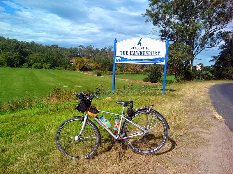
Welcome to the Hawkesbury


The Sackville Ferry is a cable ferry across the Hawkesbury River connecting the communities of Sackville, on the north/west bank of the river, and Sackville North, on the south/east bank.

Sackville Crossing

The ferry is operated by a private sector operator under contract to New South Wales Roads and Maritime Services (RMS), carries a maximum of 12 cars at a time, and is free of tolls. The crossing is 290 metres (950 ft) in length and takes approximately 3 minutes.

On the Ferry
The ferry operates on demand 24 hours a day, 7 days a week, but is closed for maintenance on the first Wednesday of each month between 1245 and 1515.
All aboard!


Once you are across the river, you have a nice steady climb up to Wisemans Ferry road.

You make me feel like I can fly, So high, Elevation
 
On the corner of Sackville Road and Wisemans Ferry road is a quaint little store that sells second hand books, some local produce, and life saving water and cold drinks. The nice old lady that runs the store gave me two free pears :-) How sweet of her.

Free Pears

from old lady who owns this store
Wisemans Ferry road has got a nice decent shoulder for most of the way, but do be careful as you get to Cattai road and subsequently Pitt Town road as there are sections that are void of shoulders requiring the rider to share the road with some enthusiastic motor bikers and Sunday drivers out enjoying the weather. However, most motorist give you plenty of room and I've always been shown plenty of courtesy on this stretch of road.

Pitt Town - Note the Small Shoulder
If you have time, take a right just past the Cattai National park sign into Cattai Bridge Reserve, there's a short dirt road down to the creek which makes for a nice little intermission for lunch or snack.
Cattai Creek

Before you know it, you're at the intersection of Pitt Town Rd and Windsor road. I headed back to Windsor to get some of the tastiest pies this side of Windsor :-) That mash potato really did hit the spot giving me back some well needed carbs.

Carbs carbs carbs...yum!
The ride back home is along the Memorial Cycleway and time to hit the MP3 player again to drown the traffic. "Peace Sells... but Who's Buying" Megadeth was an appropriate choice for the last 20km's home.

Heading home


Distance: 101.58 km
Time: 4:43:43
Elevation Gain: 685 m
Calories: 3,357 C
Avg Temperature: 23.2 °C
Avg Moving Speed: 21.7 km/h
Max Speed: 48.7 km/h


Monday, May 19, 2014

Rotary Club of Erina Century Challenge

Last weekend I took part in the Rotary Club of Erina Century Challenge. The major beneficiary of the Century Challenge is Coast Shelter, an organisation located on the Central Coast, which attempts to meet the needs of the disadvantaged within our community through advocacy and the provision of direct services. Coast Shelter provides accommodation to approximately 110 homeless men, women and children each night and also coordinates the provision of over 200 meals each day at the Donnison Street Community Centre.

A couple of my cycling friends and I have taken up the challenge several years in a row now, and it is fast becoming one of our favorite rides of the charity circuit.

We have been blessed with some wonderful Autumn weather of late and Sunday morning was no exception.

Waiting for Gadot

I drove up from Sydney and parked in the Mt Penang Parkland reserve. Always keen, I showed up 30 minutes before the 7:00am on-the-day registration booth opened. So I sat in my car listening to Megadeth's Countdown to Extinction getting pumped for the big ride ahead.

When 7:00am finally came around I rode my bike over to the registration tent and waited for Patrich and Jim to show up.

We took an opportunity to take some photos and talk about Cadel's great start to the Giro.

Jim showing off his new "Vecchi Grassi Bastardi Cycling" Kit


Patrich just showing off


The Rotary club representative gave us a fine welcome and sent us on our way.

The ride itself goes through some wonderful central coast roads with some nice climbs and nice long smooth descents.
The first climb of the day start at approximately the 10km mark as you climb out of Brisbane Water National Park and make your way up to Peats Ridge road.
The last climb of the day, and it's a doozy, comes at approximately the 90km. Here you go up and down to Somersby Waterfall and Picnic area, the elevation profile does not do them any justice at all.  
The official starting line moved a little this year making the ride just short of 100km at 98.78km. I rode up to the old starting line and back to get my Garmin clicking over to the 100km mark.


Elevation Profile


All in all, it was a great ride and one that I will be doing again.

Distance: 100.67 km
Elevation Gain: 1,235 m
Calories: 3,945 C
Avg Temperature: 18.6 °C
Time: 3:42:13
Avg Speed:27.2 km/h
Max Speed:62.8 km/h


Tuesday, May 13, 2014

Random Photos from the Archives

I was trolling through my photos on the computer and stumbled across these pictures from last years Gong Ride, is that a smile or a grimace :-)

I'll post more photos of past rides as I come across them.

It did also get me thinking that the Rotary Club of Erina's Century Challenge is on this weekend. I hope to see you there.

http://www.centurychallenge.com.au/


Wednesday, April 23, 2014

Portland NSW to Mt Horrible via Cupits Lane (Winburndale Nature Reserve) Bicycle Trip


I set out for a prospecting tour of Hill End yesterday that didn't quite go to plan. The First 20km were undulating with quite steep hills (I actually prefer long steep hills as you can at least get into a rhythm). This wasn’t quite the case with these really steep and short climbs, just as you start getting into some kind of rhythm you are over it and into a short descent only to hit another wall.
Dark Corner Road Bike Touring
Some where on Dark Corner Road
 

I then turned into what I knew would be 25kms of dirt road. It was hard to determine the condition of the roads as Google Mobil did not cover this area. Boy oh boy, big lesson learnt. If Google Mobil doesn’t go through a road, it’s not a road!

Trip Route
 

I covered 20km’s of what was complete wilderness, beautiful and remote. It was hard to enjoy it though as I could not take my eyes off the road straight ahead of me as I surely would have come off. The road was nothing more than a poorly maintained fire trail. Great if you were in a four wheel drive, not on skinny tires without front suspension. Having said that, the bike handled beautifully. There were times I was sure I was going to break a spoke or tear a tire on the sharp shrapnel like stones/boulders but the DT Swiss spokes/Mavic wheels and Schwalbe Marathon Plus tires worked well above my expectations. The Brooks Flyer really showed its value yet again as I was relatively comfortable in my saddle.

My thought process getting on to Cupits Lane from Dark Corner sort of went like this .

“Oh boy, this is not a road, it’s nothing more than a goat track, but there’s no track! I’m going to have to make my own”


As I’m pedaling and building up a sweat, I hear a dog barking, startling me and nearly throwing me off my bike. I take my eyes off the road for a brief moment to see a farmer on a quad looking down at me in amazement.

“You’d be better off on one of these mate” he said.
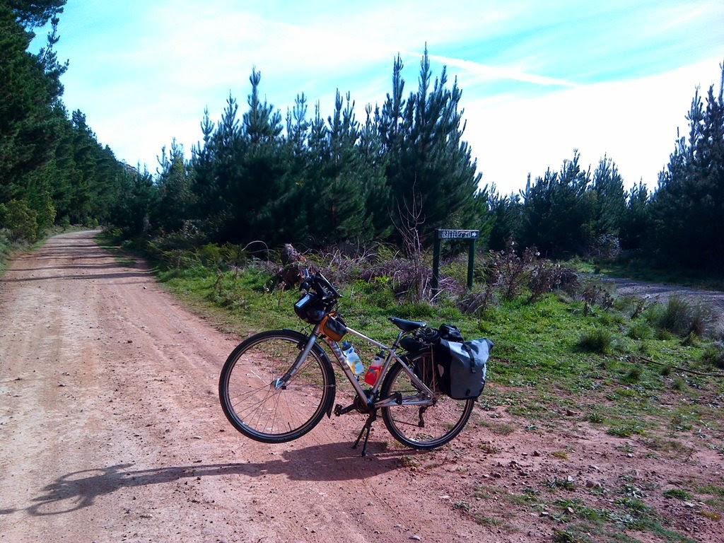
 
Cupits Lane Battery Rd Intersection
Cupits Lane/Battery Rd Intersection (The rare decent section of road)
I smiled back all the whilst thinking, you’re not wrong mate, this is crazy. The fact that I saw someone on Cupits lane so early on gave me a false sense of security. The road was surely going to improve because this guy got here somehow. The problem was that he was the only person I saw in the proceeding 5 hours.

My brain wouldn’t let  up though.
 
Eskdale Rd NSW
Off Eskdale Road (I really should take GPS coordinates with my photos)
 
“Come on Pete, GPS says that Cupits lane turns into Eskdale Rd, surely a road has got to be better than this lane, right? Right?”
 
So I’m counting down the kilometers, 4… 3… 2… 1… I see the turn off, and the GPS confirms I’m now on Eskdale rd. Do I notice a change in the road condition or is it wishful thinking? I don’t know but I’m committed.

The road was undulating, poorly maintained and in the middle of nowhere. I was too afraid to take my eyes off it in fear of becoming fodder for the eagles I could hear and see in the not too distant pines. I stop for half a Nutella sandwich on a camp site on the side of the road and take it all in. What a beautiful country.
 
 
Winburndale Nature Reserve
Time for a Nutella Sandwich
 
“Am I the only crazy guy who has ever ridden an oversized road bike in the middle of Winburndale Nature reserve?”

The road has not improved significantly. Every bolder, dip ,puddle, soft sand, shrapnel like stone I hit does nothing to stop counting down the kilometers. 15…14 ….13… 3..2…1… Surely Mt Horrible has got to be better.


“Doh!”

 I hit Mt Horrible road and I start to ponder doing this again tomorrow with another 160km of riding on my legs. No, it’s not to be. I can hear Crazy Pete and Sensible Pete having a conversation in my head.

 Crazy Pete:

“5 km’s more on Mt Horrible and then you’ll have smooth riding.”

Sensible Pete:

“Turn back, do another 20km now of this Australian Paris-Roubaix version of the cobbled classic knowing you’ll be back to mum's spaghetti with garlic, chili and oil in about 3 hours  (my starting position for the day) and spend the night with my wife and kids.”

A vision of my daughters comes into my head and I know what I have to do. I turn back and start counting the Km’s again. Sensible Pete pats Crazy Pete on the back and whips him back into action.
 
Distance:78.15 km
Time:5:23:28
Avg Speed:14.5 km/h
Elevation Gain:1,163 m
Calories:2,512 C
Avg Temperature:16.5 °C

Elevation Guide


Recommendations:- The road from Cupits Lane/Eskdale Road to Mt Horrible is quite remote and isolated. I rode this on a weekday between Easter and Anzac Day and did not see or hear any other motorist/cyclist/pedestrian or any other human being for the duration. If your mountain bike is equipped with front suspension, then this would make a nice outing with your mountain bike friends. I don't recommend you do the ride alone as phone coverage is non existent, and it may take a while for someone to come to your aid. I also don't recommend you do this ride on a touring bike as I did. Do as I say, not as I do :-)